
 |
| We arrived in the west and moved east along the coast. |
The Wild Atlantic Way.
Massive rugged storm lashed cliffs fall dark and broken into white
foamy sea which claws at them relentlessly from murky grey depths.
Treacherous jagged rocky post glacial remnants lurk off their perilous
fringes, decorated with the treasures of countless wrecks, old and new.
Watchtowers, falling down and tired remnants of the Napoleonic period
struggle to attention on every hilltop. Cleaved to the cliffs, various
ruined castles cast a baleful eye over us as we make our way along the
southern Irish coastline through sun and rain, mist and fog, marveling
at the beauty, power and history.
 |
| Some of the fishing vessels in Castletownbere. |
 |
| Castletownbere. |
 Farmers fishermen and summer revelers frequent the quaint little villages on their various
business. Castletownbere sits snug in a tiny dredged harbor, home to
the whitefish fleet numbering over 80 ships, some from EU countries,
Spain and France predominantly. The biggest whitefish fleet in Europe.
Farmers fishermen and summer revelers frequent the quaint little villages on their various
business. Castletownbere sits snug in a tiny dredged harbor, home to
the whitefish fleet numbering over 80 ships, some from EU countries,
Spain and France predominantly. The biggest whitefish fleet in Europe.
We
dined in Castletownbere for Sunday lunch at Murphys, of course! The
fare was simple, well cooked and followed by one of the many delicious
deserts available. Patrick O'Sullivan was fated to have us accompany him
during our lunch as the restaurant was understandably full. He obliged
by regaling us with the local stories, gossip and legends as well as
some useful facts about the life and times in the area. He then walked
with us and pointed out the various places of interest. I had the best
Irish coffee in Ireland at the local Pub later before we all returned to
Taipan on the anchor in the small harbor.
Monday involved a
quick trip to the local Fisherman's coop to pick up a few bits n pieces
for the boat. Always a cheaper option than the Marine Chandlers.

 Next
stop was Crookhaven. The deeply indented coastline topped by Ballyroon
Mountain form a stunning backdrop as we sail across Bantry Bay, around
Sheeps Head, Three Castle Head, Mizen Head and Brow Head. The famous
Fastnet Rock just 10 nm to our south as we head into the very sheltered
and pretty Crookshaven anchorage.
Next
stop was Crookhaven. The deeply indented coastline topped by Ballyroon
Mountain form a stunning backdrop as we sail across Bantry Bay, around
Sheeps Head, Three Castle Head, Mizen Head and Brow Head. The famous
Fastnet Rock just 10 nm to our south as we head into the very sheltered
and pretty Crookshaven anchorage.
The weather hasn't been great with constant mist and poor visibility. We did spot the Three Castles for which the head is named. They were apparently a folly built by some noble lord in the period past when castles were the architectural fashion. They are now ruins but are apparently a popular walking destination being set upon a pretty little lake in among dramatic rocky countryside, and of course with an outstanding view.

 Next
stop was Crookhaven. The deeply indented coastline topped by Ballyroon
Mountain form a stunning backdrop as we sail across Bantry Bay, around
Sheeps Head, Three Castle Head, Mizen Head and Brow Head. The famous
Fastnet Rock just 10 nm to our south as we head into the very sheltered
and pretty Crookshaven anchorage.
Next
stop was Crookhaven. The deeply indented coastline topped by Ballyroon
Mountain form a stunning backdrop as we sail across Bantry Bay, around
Sheeps Head, Three Castle Head, Mizen Head and Brow Head. The famous
Fastnet Rock just 10 nm to our south as we head into the very sheltered
and pretty Crookshaven anchorage. The weather hasn't been great with constant mist and poor visibility. We did spot the Three Castles for which the head is named. They were apparently a folly built by some noble lord in the period past when castles were the architectural fashion. They are now ruins but are apparently a popular walking destination being set upon a pretty little lake in among dramatic rocky countryside, and of course with an outstanding view.

Crookshaven,
probably named for the crooks who frequented the area in times past as
pirates and wreckers. The coastline was notoriously dangerous and to add
insult to injury it wasn't unknown for wreckers to be active in the
area, luring unsuspecting ships onto the rocks to slaughter crews and
passengers and to steal their cargoes.
Today however it's a pretty town, albeit shrouded in mist, set on a narrow promontory and forming a fairly deep and well protected anchorage. The last port for most ships bound for the New World. The two and a half million immigrants headed to the Americas would have fare welled Europe here and headed to the vast beyond with hope in their hearts and dread in their eyes. Marconi was based in town while he experimented with radio telegraph for sending and receiving Morse Code. We saw the small cottage he was living in at that time. He abandoned Crookhaven in favor of Rosslare Strand, Co Wexford After discovering that the copper rich rocks in the mountains were interfering with his signals.
 | |
| Crookhaven |
Today however it's a pretty town, albeit shrouded in mist, set on a narrow promontory and forming a fairly deep and well protected anchorage. The last port for most ships bound for the New World. The two and a half million immigrants headed to the Americas would have fare welled Europe here and headed to the vast beyond with hope in their hearts and dread in their eyes. Marconi was based in town while he experimented with radio telegraph for sending and receiving Morse Code. We saw the small cottage he was living in at that time. He abandoned Crookhaven in favor of Rosslare Strand, Co Wexford After discovering that the copper rich rocks in the mountains were interfering with his signals.
 While exploring
the little village we met a gentleman with two small boys who were
heading out fishing. Later we met them again and were presented with six
big fat mackerel along with instructions for catching the same. Armed
with this new knowledge and eager to put it into practice, Captain Dave
rigged the line and promptly pulled in another 6 fat mackerel even
managing a triple header! So we were assured of another dinner as we set
out for Schull the following morning.
While exploring
the little village we met a gentleman with two small boys who were
heading out fishing. Later we met them again and were presented with six
big fat mackerel along with instructions for catching the same. Armed
with this new knowledge and eager to put it into practice, Captain Dave
rigged the line and promptly pulled in another 6 fat mackerel even
managing a triple header! So we were assured of another dinner as we set
out for Schull the following morning.
Navigating the narrow
Long Island Channel the short distance to Schull was very scenic with
pretty farms dotting the small fields on the islands and mainland. We
were treated to a rare delight as the sun shone through the clouds for
most of the afternoon making for excellent exploring weather in Schull.
Here we met Deirdre Crowley, an exuberant artist currently exhibiting in Schull.
She was fascinated by our story and took a great photo of the three of
us in front of one of her works. Schull is a reasonably large village
for the area and we spent several hours walking the streets checking the
pubs and just getting exercise.


Next stop Baltimore was a
mere 8nm away, through narrow convoluted channels and around numerous
rocky islands. Low and pastured they too are small farms. Heaven knows
how they get their stock to market but we did see some trailers which
look like they go on local barges.
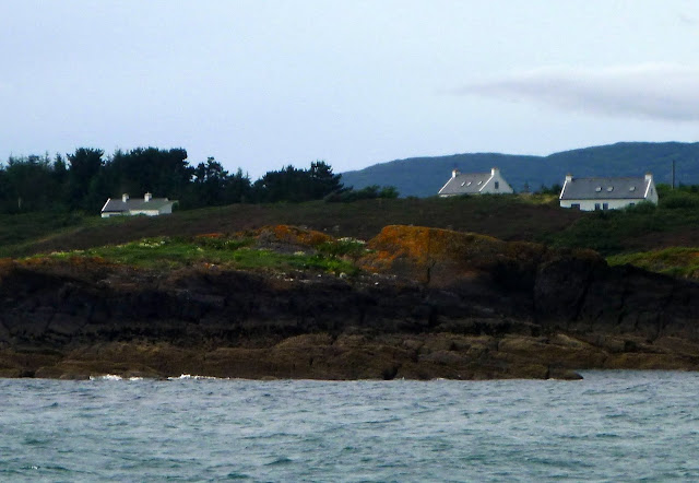
The cottages are stone and nestle down in valleys sheltered, I imagine, from the howling, freezing winter gales. Today though the kids are out in small sailboats racing around the relatively protected waters off Skelkin Island, undeterred by the misty threatening weather. It is after all, summer in Ireland and they are taking their summer holidays seriously. Baltimore was much smaller than it looked on the map but a pleasant spot to walk the legs and reestablish acquaintance with the he blood supply to them.
Photos from Crookhaven Castletownber Baltimore and Schull

45nm east is Kinsale, a delightful small village built 5 miles upstream
on the river Bandon. The weather was awful. Windy, wet and cold with a
fair following sea. At least the wind was behind the beam. With one reef
we managed good time and rounded Old Head of Kinsale, one if Ireland's
oldest light houses, early in the afternoon. The Lusitania was lost
just 11 miles off this headland when it was torpedoed by German
U Boat. U20 in 1916. There was significant loss of life and a third of
the passengers were American. This attack on a civilian vessel
contributed to the American decision to enter the war with Britain
against Germany.
 |
| Old Head Lighthouse. One of the oldest lights in Ireland |
During the passage we were followed for a
while by an Irish Navy patrol boat P42, and then they called us for details
of vessel and crew. We encountered them as we entered Brandon River
mouth where they were anchored up out of the weather.
Charles Fort stands guard on the East side and James Fort on the west. They provide a startling reminder of the history of British rule and the intermittent Spanish and French involvement in Irish affairs over the centuries. Charles Fort was to provide us with an interesting and informative adventure in the coming days. James Fort, long abandoned and now a ruin, was also visited.
 |
| Charles Fort. Kinsale. |

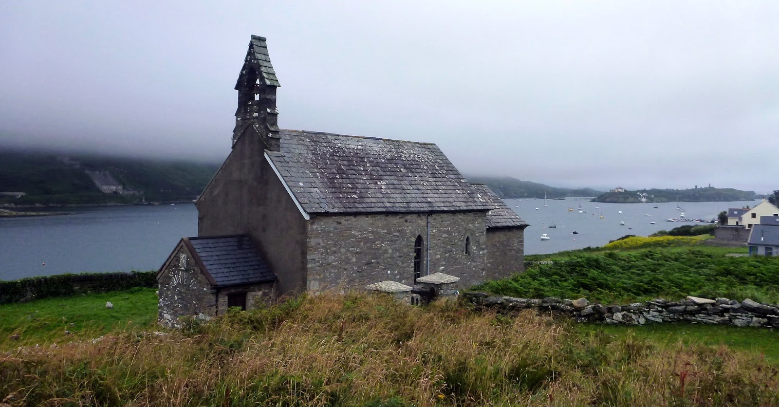
A very ancient Celtic religious site now the site of Church of St Mutose Whilst the building is 850 years old, it has been a site of continuous Christian worship for of worship for over 1300 years.
Lovely little shops and a small castle in town kept us busy on our feet all day each day. Shopping for provisions was easily achieved with several supermarkets right on the waterfront.

On day two we dinged downriver to Summer Cove and walked to Charles Fort where we spent an entertaining morning being further educated in confusing and convoluted Irish history. The first fortification was built of earth and timber on the site of an earlier fortification called Ringcurren Castle. This was followed by a more substantial construction of a Star shape fort in1670's and 80's. It was besieged in 1690 in the Williamite War. In a combined land and sea operation, Williamite commander Marlborough, took the city and captured 5,000 Jacobite prisoners. Repairs were made after the seige and the and the British used it as an army barracks for over 200 years.
 |
| Charles Fort |
In
the afternoon we watched the charity fun raft race on the river and
then took the dingy to James Fort. A more leisurely pace with no guides
or entrance fee. The main fort structure is walled off and gated as it
is unsafe to enter. A short climb down to the river there is a Block
House. It was fortified with 2 levels of cannon and a tunnel ran under
the hill from the block house to the main fortification. This has been
blocked off, much to David and Patrick's chagrin.
 | |
| James Fort |
Kinsale has
numerous eateries and many of a fine standard. Patrick, being our
resident epicurean maestro, was suitably impressed. There are also
visitor moorings here and we could easily have arranged to leave to boat
and tour by car for a few days. The hinterland looked very interesting
especially to the west with the remnant glacial rocky lakeland and
scoured hillsides offering great walking trips and scenic countryside.


All
to soon we have to move on again. This time to Cork about 40nm to the
east.
Link to more photos from Kinsale.
Link to more photos from Kinsale.