Wednesday 11th July. This morning we left our beautiful north Belitung anchorage to start heading to Cocos Keeling. We only did a 20 nm run to S2'50.48 E107'29.36 into the Perlak River mouth. Very calm and quiet. A few fishing boats left at dusk otherwise no one. We had our first rain while underway.. since Langkawi. It was really just a little spit and barely needed covers!
Thursday 12th July. Moving on towards the southern end of Belitung. Beautiful sunny day with only 4 to 5 knots so we are motor sailing. Dolphins around but pretty wary!
Anchorage at Seliu Isl at 3'11.67S 107'32.30E at the south end of Belitung. Small village ashore friendly waving. Rained at sundown.
Anchorage at Seliu Isl at 3'11.67S 107'32.30E at the south end of Belitung. Small village ashore friendly waving. Rained at sundown.
Friday. Left to head south to 1000 island group at 6.30 am Friday morning via the Chanel between Seliu and Belitung. Good clear run. Charts seem accurate. 150 nm to go.
Uneventful night. Good wind and we made good time in reasonable comfort.
 |
| Local fishing boat off the Jetty near our anchorage at Harapan Island in the 1000 Island group |
.
 |
| Buhari and Captain |
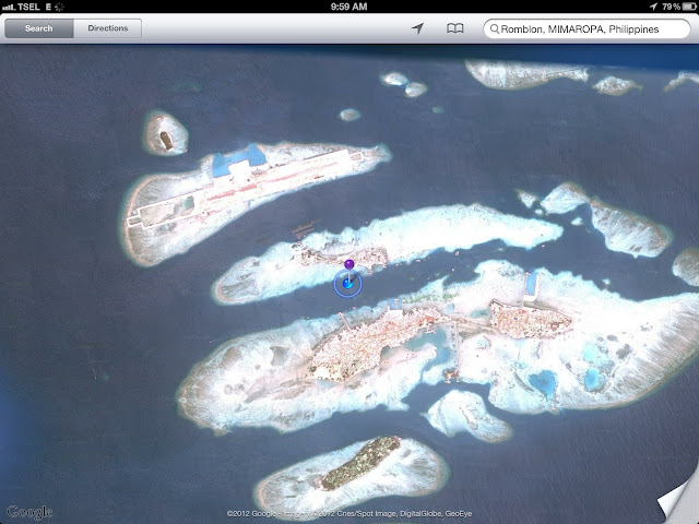
Its very beautiful here. Lots of coral atolls rising straight up out of 20M of water. Fortunately it was very fine and sunny by the time we were making our way in and the edges were easy to see. We are only a few meters from a fish farm and could easily swim to the reef but it's a bit busy with boats.
 |
| Streets of Harapan |
Buhari (62 ). O87881329233
 |
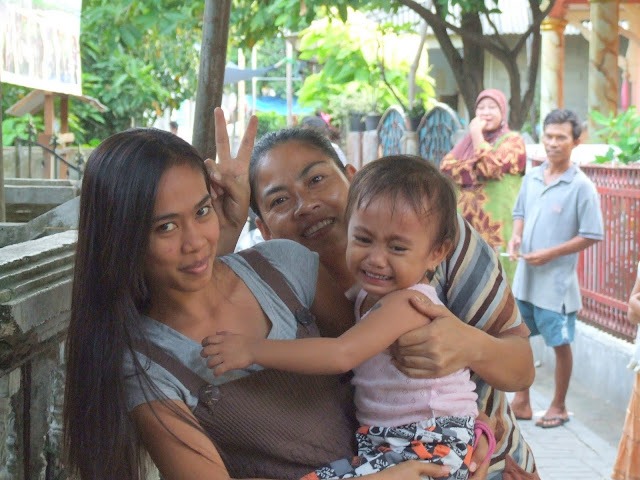
| Others tolerated it while Mum loved it! |
 |
| Despite Mums insistence...some kids just were not keen to be in the pictures!! |
We made our way up very narrow streets, about 6 ft wide. Paved in concrete bricks between a variety of closely packed houses mosques and small shops. The only vehicles were bicycles tri-shaws and motorbikes. Many, many babies all needed photos and some were very reluctant in spite of their mothers insistence. We encountered street sellers with delicious satay ayam. Chicken, and pastries filled with nameless yummy stuff but strangest of all was a contrivance to rival anything we have seen!
 |
| This guy made yummy fried things??? |
It was a one man driven, musical children's ride, mounted upon a trishaws cycle. The whole contraption drives round the island selling rides to tots, 4 at a time, on small vehicles which go up and down like merry go round horses, but in one place. Everyone was extremely friendly and welcoming.
 |
| Man powered Merry go Round |
There were lots of Mosques and the islanders are obviously devout, however, as we have often experienced in the more remote islands of Indonesia, we felt the Islam we saw in practice here was far less oppressive, and especially the women appeared to be free of a lot of the constraints seen elsewhere.
Sunday 15th We are heading towards Sunda Strait and will go to Krakatau tomorrow. Everywhere in Indonesia needed more time!
A note on Charts
We have a Furuno Navnet 3D Chart Plotter running CMap derived charts from Maptec but the best charts we had for this area were on the iPad running in an App called JeppesenPlan2Nav. The charts are small area and reasonably pricey but very very good.
More Photos from Indonesia

